 Enslavement
to
freedom

Study Areas
Anti-Slavery
Harrisburg Underground Railroad Sites
Third and Mulberry Streets, Harrisburg (Judystown)
This neighborhood included the home of Edward "King" Bennett (born c.1805), an African American community leader and a coordinator of Underground Railroad activity in the town. This location was nicknamed Judystown, for Judy Richards, a community matriarch. Her daughter Mary Ann married Bennett, who built a successful chimney sweeping business. Judystown was Harrisburg's first distinct African American community, and as such was probably the first place in the town in which organized Underground Railroad activity took place. It was the spiritual center for Harrisburg's African American population, housing the Wesley Union A.M.E. church, on the southeast corner, from 1829 until it moved several blocks away in 1839 (see "Tanner's Alley"). Bennett, found in the 1850 census, was a church leader, listing his occupation in 1850 as "preacher." His neighbors in Judystown, in 1850, included George Galbraith, an ordained minister in the A.M.E. church, and David Stevens, a young preacher who would serve as a chaplain to African American regiments during the Civil War. Bennett's URR involvement has been cited by nineteenth century historians William Henry Egle and George H. Morgan.
This site is now occupied by the Mulberry Crossing Apartment Complex. (More)
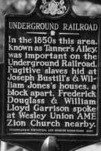
Tanner's Alley, Harrisburg
The Tanner's Alley site is the only place in Harrisburg recognized by the state Historical and Museum Commission with an Underground Railroad historical marker. Located in the notorious Eighth Ward, a mixed-race, multicultural district located between the capitol building and the railroad and canal, Tanner's Alley was the center of the neighborhood that included Short Street, Cranberry Street, Filbert Street, Angle Alley, and South Street. So many African Americans lived in this portion of the ward that the entire neighborhood, seen as a distinct African American community, became known as Tanner's Alley.
This African American neighborhood began to develop in the late 1830's, and in 1839 the Wesley Union congregation relocated to a lot at the corner of South Street and Tanner's Alley. From this point on, the Tanner's Alley community began to assume increasing importance in the provision of aid for fugitive slaves. Another church, the Bethel A.M.E. Zion, began as a small congregation on Short Street about 1858. They later relocated to a lot on State Street, still within the Eighth Ward.
The significance of Tanner's Alley to the URR is well documented. In September 1849, a family of fugitives was rescued from slave catchers who had brought them to Harrisburg, and the fugitives were hidden in the homes of African Americans on Short Street. A neighborhood watch was then set up on Short Street to guard against raids by local authorities to recapture the fugitives. Joseph Bustill, a Philadelphia URR activist, moved to this neighborhood and began operations in the spring of 1856. His correspondence during this period, with William Still, chairman of the Vigilance Committee of the Pennsylvania Anti-Slavery Society, has been preserved and documents his activity in receiving and forwarding fugitives along the network.
Tanner's Alley, along with much of the rest of the Eighth Ward, was razed from 1912 through 1936 for the expansion of the Capital complex. Nothing remains of this neighborhood.
Residences of William W. Rutherford and Rudolph Kelker
(9 and 11 S. Front Street, Harrisburg)
Dr. William Wilson Rutherford, a member of the large and actively anti-slavery Rutherfords of Paxtang, was a physician living and practicing in Harrisburg. As president of the Harrisburg Anti-Slavery Society, Rutherford had arranged for Frederick Douglass and William Lloyd Garrison to visit Harrisburg in 1847. His home, at 11 S. Front Street in Harrisburg, is generally accepted as an URR station. Located near the end of the Market Street bridge, Rutherford was said to shelter fugitives, who crossed the river from Cumberland County either at that point, or at the railroad bridge further south, in his home until they could be sent out what is present day Derry Street to the farms owned by his relatives in Swatara Township. Local lore says that a tunnel ran from Rutherford's home to the riverbank, providing covert access to and from his home for fugitives. This claim came about during the razing of his home for construction of the modern Dauphin County courthouse. It was reported that the remains of a tunnel were found under his home and that it was used during the time that freedome seekers were coming through Harrisburg. Despite Dr. Rutherford's undeniable sympathy with the movement and participation in other Underground Railroad related activities there is no evidence to support the claim that the tunnel was related to helping freedom seekers.
Rudolph Kelker, a successful hardware merchant, lived at 9 S. Front Street, next door to Dr. Rutherford. A prominent abolitionist, Kelker owned a barn at Barbara Street and River Alley, to which he was said to send fugitives who arrived at his door. The corner of River and Barbara Streets was also the location of a small African American neighborhood that included the home of William M. and Mary Jones, two active conductors on the URR.
The block that included 9 and 11 S. Front Street was torn down in 1945 to build the present day Dauphin County Courthouse. (More)
River and Barbara Streets, Harrisburg
This location, where Rudolph Kelker sent fugitives, and near the home of William and Mary Jones, URR conductors, still exists and a portion of it may still consist of structures from the time period of the URR. The south side of the intersection is a modern office building, but the north side has structures that appear to be nineteenth century structures. Unfortunately, we don't know the exact location of the URR sites, although historian Howard Wert identifies the home of William Jones as "a frame building" (wood), and no such structure still exists at this location. The older existing structures may or may not be significant.
 Chester Family Home and Restaurant, Harrisburg
George and Marie Chester operated an oyster house and restaurant on the north side of Market Street near Third. Now marked with a state historical marker for the birthplace of Thomas Morris Chester, a son of George and Marie, the site was a gathering place for anti-slavery and abolitionist activists. Abolitionist newspapers The North Star, The Liberator and others could be found here. Only the obituary of David Chester, son of George and Marie, notes Underground Railroad activity, although it is a widely held belief that the Chester home and restaurant was a station. After George Chester died in 1859, his wife Marie purchased a home at 69 Chestnut Street and moved the restaurant there. It later relocated to 305 Chestnut Street. Neither of these later locations have been associated with URR activity.
The Market Street location is now the site of Whitaker Center. (More)
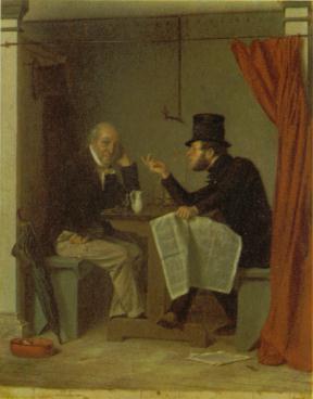
above: Richard Caton Woodville's "Politics in an Oyster House" captures the atmosphere and intimate setting, the booth curtains could be drawn for privacy, of this type of establishment. The Chester family restaurant was an oyster house, the interior of which probably saw many scenes such as the one illustrated by Woodville. Politics and the issues of the day, particularly abolition, the Fugitive Slave Act, recent incursions by slave catchers, and other items of interest to its patrons, would have been passionately debated in its booths. It is also possible that Underground Railroad activities were planned behind drawn curtains.
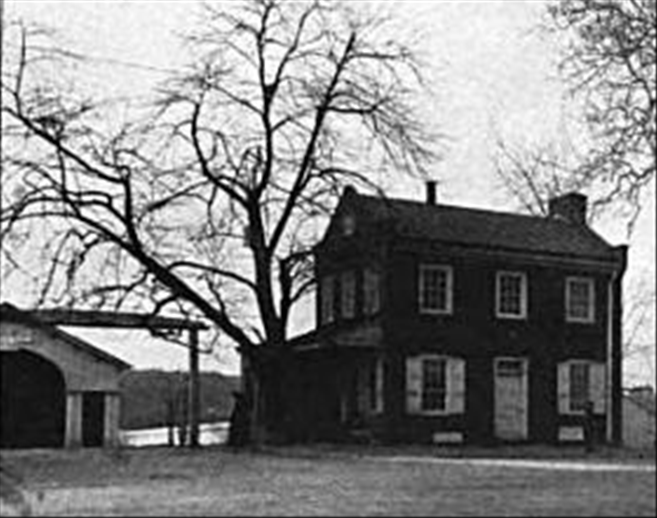
William Rutherford, Sr. Farm, Swatara Township
The Thomas Rutherford family owned about 400 acres of land in present day Swatara Township and Paxtang Borough in 1755. The original family farm was divided between two sons, William and Samuel, upon Thomas' death in 1804. William's portion was located where the Lawnford Acres Development now stands. This original farm was one of the first URR stations operated by whites in the area, and may have been operating as early as the first decade of the 1800's. A barn, built by William Rutherford in 1805, was standing until the late 1990's, and was a documented hiding place for fugitive slaves in the 1840's. William Rutherford Sr. died in 1850.
Abner Rutherford Farm, Swatara Township
Located on the west side of present day Derry Street, in the vicinity of 61st Street, Abner Rutherford's farm was used as a secondary station, when the other Rutherford farms were being watched by slave catchers. Abner, Samuel S. and William W. were all sons of William Rutherford Sr.
Because of the realignment of Derry Street and the construction of the Rutherford Railroad Yards, no traces of Abner Rutherford's farm exist today.
Samuel S. Rutherford ("Little Sam") Farm, Paxtang
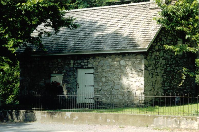 William
W. Rutherford sent fugitives from his Front Street home to the farm
of his brother Sam, in Paxtang. They may also have traveled further
east on the turnpike (now Derry Street) to one of the other Rutherford
farms, mentioned above. Two structures from this farm are still standing
today. The mansion house, built in 1858, is visible from Interstate
83 and is owned by the County of Dauphin, which maintains it as a senior
center. The stone house, also known as the springhouse, is located on Paxtang Parkway, beneath the
Interstate 83 overpass. While it is possible that freedom seekers were sheltered
in the stone springhouse at one time, it is more probably that a barn, which
is no longer standing, was used instead. There are no stories or evidence
that mention the use of the mansion house as a shelter for freedom
seekers. The barn that was used was torn down when the highway was
constructed in the 1960's.
William
W. Rutherford sent fugitives from his Front Street home to the farm
of his brother Sam, in Paxtang. They may also have traveled further
east on the turnpike (now Derry Street) to one of the other Rutherford
farms, mentioned above. Two structures from this farm are still standing
today. The mansion house, built in 1858, is visible from Interstate
83 and is owned by the County of Dauphin, which maintains it as a senior
center. The stone house, also known as the springhouse, is located on Paxtang Parkway, beneath the
Interstate 83 overpass. While it is possible that freedom seekers were sheltered
in the stone springhouse at one time, it is more probably that a barn, which
is no longer standing, was used instead. There are no stories or evidence
that mention the use of the mansion house as a shelter for freedom
seekers. The barn that was used was torn down when the highway was
constructed in the 1960's.
Old Images of Other Sites
The structures below are no longer in existence.
 Lithograph
of the two main bridges into Harrisburg in the 1840s through the 1860s.
At left is the Camel Back Bridge, with the western span still intact,
and the eastern replacement span.
Lithograph
of the two main bridges into Harrisburg in the 1840s through the 1860s.
At left is the Camel Back Bridge, with the western span still intact,
and the eastern replacement span.
Both bridges were utilized by freedom seekers to cross into Harrisburg. (More)
Image from The Harrisburg Board of Trade, Industrial and Commercial Resources of the City of Harrisburg, Dauphin County, PA (Harrisburg, PA: Board of Trade, 1887) opp p. 10.
 Old
tollhouse at the eastern end of the Market Street Bridge. The Market
Street Bridge was also known as the Camel Back Bridge, and it carried
the turnpike road from Cumberland County over the Susquehanna River
into Harrisburg. It was designed by Theodore Burr and opened in 1817.
Old
tollhouse at the eastern end of the Market Street Bridge. The Market
Street Bridge was also known as the Camel Back Bridge, and it carried
the turnpike road from Cumberland County over the Susquehanna River
into Harrisburg. It was designed by Theodore Burr and opened in 1817.
The entrance to the eastern span of the bridge, which was built in 1847 to replace the portion washed away by a flood the year before, is shown.
Image from Civil Club of Harrisburg, Proceedings at the Dedication of the Market Street Entrance to the City of Harrisburg, PA (Harrisburg, PA: Mount Pleasant Press, 1906) p. 16. (More)
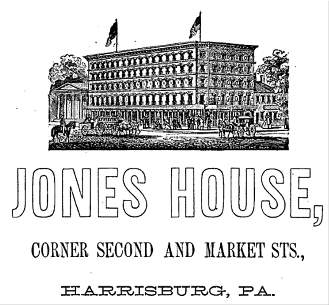 Advertisement
for the Jones House, on Market Square in Harrisburg.
Advertisement
for the Jones House, on Market Square in Harrisburg.
This location was considered one of Harrisburg's finest hotels, and it regularly hosted visiting Southern slave catchers, politicians, news reporters, and celebrities.
The most famous guest was President-elect Abraham Lincoln, who stayed here on his way to his inauguration in Washington, in 1861. (More)
Image from Seltzer and Thome, Directory of Harrisburg, Pennsylvania (Philadelphia: Sherman & Co., 1869) p. 3.
 Covering the history of African Americans in central Pennsylvania from the colonial era through the Civil War.
Support the Afrolumens Project. Read the books:
The Year of Jubilee, Volume One: Men of God, Volume Two: Men of Muscle